
Augmented Reality Sandbox
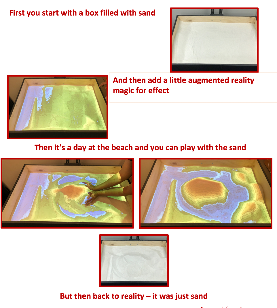
The project combines 3D visualization applications with a hands-on sandbox exhibit to teach earth science concepts. The augmented reality (AR) sandbox allows users to create topography models by shaping real sand, which is then augmented in real time by an elevation color map, topographic contour lines, and simulated water. The system teaches geographic, geologic, and hydrologic concepts such as how to read a topography map, the meaning of contour lines, watersheds, catchment areas, levees, etc.**
Would you like to learn more? We'd be happy to meet and discuss how tto utilize this project in both reaseach and classroom projects.
The Augmented Reality Sandbox was developed by the UC Davis W.M. Keck Center for Active Visualization in the Earth Sciences (KeckCAVES, http://www.keckcaves.org), supported by the National Science Foundation under Grant No. DRL 1114663.
For more information, please visit https://arsandbox.ucdavis.edu.
**Text courtesy of https://arsandbox.ucdavis.edu/about/